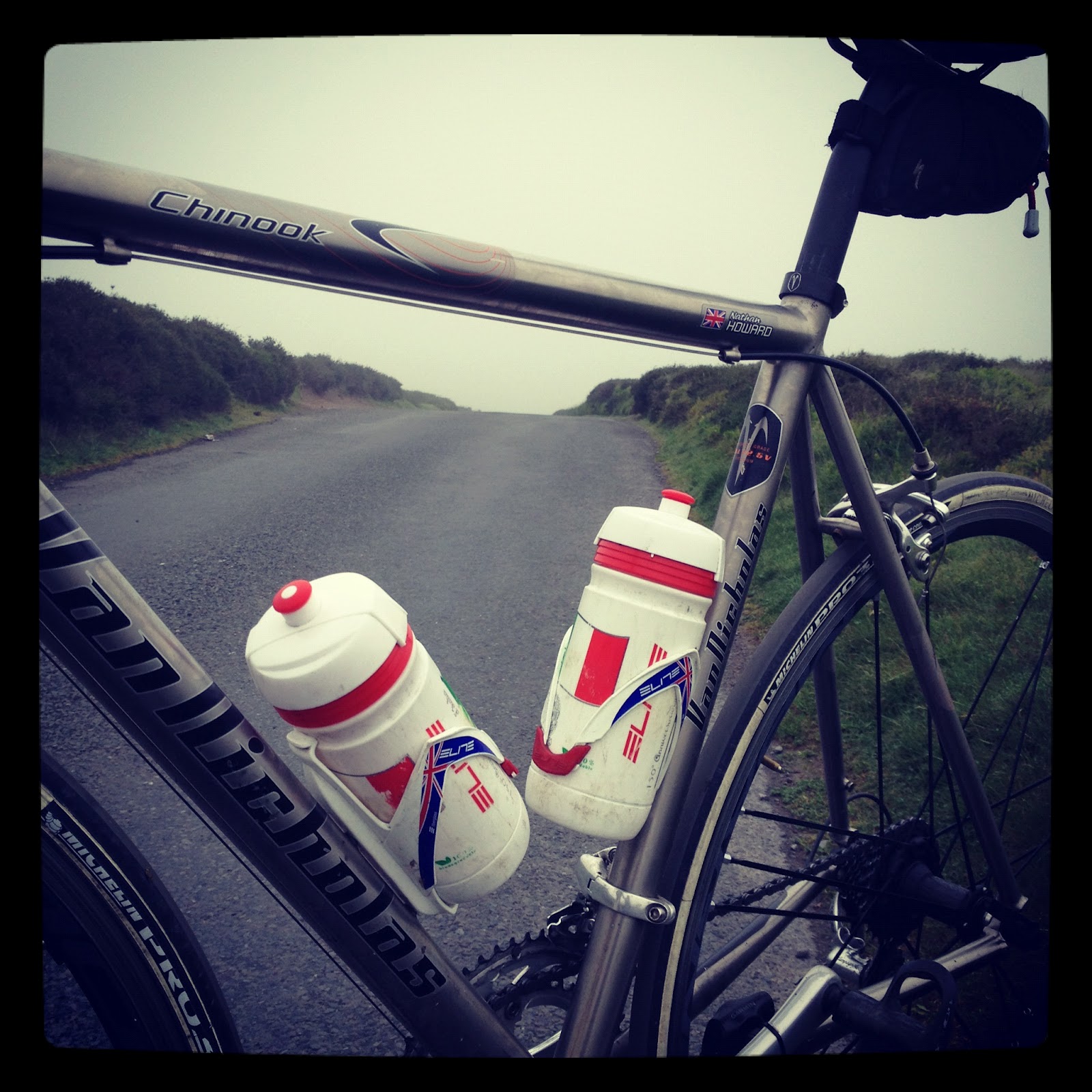
Thursday, 21 June 2012

Tour de Wales - Day 4


Our B&B in Bala was a small, 2-bedroom terraced house, run by the lovely (and quite elderly) Gwenith. She was a fantastic host and made us feel very welcome, but I did get the impression that she was completely bemused by the fact that we had pitched up with a car full of wet kit, two bikes, and the intent to cycle around the area no matter what the weather (i.e. in heavy rain). Each time she asked us a question, she would follow up the answer with an “oooh” (try to imagine it with a very Welsh accent), and then a puzzled look would cross her face and she would chuckle slightly to herself as if thinking “the youth of today…”. One thing she had no confusion about, however, is how much food it takes at breakfast to fuel up an hungry cyclist who was about to embark on the fourth day straight of riding up Wales’ steepest hills. Cereal, toast, tea, juice and beans on toast (a revelation for breakfast!) later and we were ready to hit the road.

Things ground to a halt quickly after turning on the satnav and realising that the planned drive to Merthyr Tydfil was going to take three hours, if not longer judging by the lack of multi-lane highways and quantity of slow-moving traffic on the roads so far. Rather than drive all the way South, just to come back up afterwards, we decided to swap a couple of rides around and that I would do the ride that started in the Cambrian Mountains and then crossed the Brecon Beacons. While I had all the routes mapped out in the Garmin, it did mean that all of the reading-up of the climbs and studying the route that I had done the night before had now gone out of the window, and I would pretty much have to rely on blindly following the little pink line on the computer. This turned out to be a bit of an obstacle when trying to find the first hill: the ominously named “Devil’s Staircase”…

Starting in the town of Beulah, I knew that I had to do a loop around a small road in a forest, and somewhere on that loop I’d find the climb. However, having ridden for a while and with 15 miles on the clock, I ended up back where I started, having ridden the loop and seen no sign of a killer 9/10 climb, and now with the rain starting to come down. One recurring theme of our trip to Wales so far was the complete lack of mobile phone reception – let alone anything resembling 3G internet connection. Huddled over my A4 printed map (completely devoid of detail) to keep it dry, it just wasn’t clear where this bloody hill was located. Now we all know that men hate asking for directions – we’re solitary creatures at heart, and like to work things out ourselves. Now picture that scenario, but dressed in lycra, in the knowledge that you’ve just wasted an hour of precious riding time, and with the rain pouring down. Oh, and as an Englishman (with fairly posh accent) in rural Wales. Sadly, there was little option – I had come this far and there was no way that I was about to go home without bagging this damn climb. Looking around, I didn’t have much choice as to who to ask so I bit my lip and asked a helpful looking chap who appeared to be clearing out his garage. A bit of umming-and-ahhing later, and a fair bit of Welsh consultation with his Dad, I found out that I had missed a crucial (but hidden) right turn in the loop, and that I was about 10 miles away from my intended climb! Frustrated to the max, I thanked them profusely for their help and then set off down exactly the same route that I had already seen earlier on.

As the roads got smaller and more isolated, I finally turned off the forested loop and set off up the valley into the wind. Completely unfenced, the fields were full of sheep who seemed to think nothing of staying completely still as I approached them, only to suddenly dart out infront of my wheels as I was only metres away. I suspect that the ‘head sheep’ must have put a dare out as to who could make it the closest to a speeding cyclist without getting injured, but I have to say that in the wind and the rain, I could have done without having to also dodge fast-moving sheep. Unfortunately, yelling “mint sauce” didn’t do much to make them move, so it was probably a good thing that no-one was around to witness this particular part of the ride.

View from the Devil's Staircase
It was a relief to finally be at the base of the climb, and even though it was torturously steep and went on for a good distance, I pretty pleased to be actually achieving what I had set out to do that morning. Nothing like a few 30% hairpins to put a smile on your face! The views at the top were a little muted due to the weather, but I would imagine it looks amazing in the sunshine. For the third time, I made my way back to Beulah, where I indulged myself in a Snickers Duo (essentially two full Snickers bars in one wrapper – pure chocolate inflation, there) and hid under a petrol station roof while I wolfed it down. The look on the nearby sheep’s faces said it all really – I have no idea what I was doing there, either:

Yes sheep, you're right. This is no day to
be out in the great outdoors
Pushing on, I was a bit confused to be confronted with a massive hill ahead of me – not one that I had been expecting. The B4519 crosses a military firing range, it turns out, as well as being a natural funnel for the South-Westerly that was rapidly picking up pace. At the bottom of the climb was a large sign which read “Do not proceed if red flag flying”. With no red flag in sight, I didn’t pay this too much attention and continued to battle against the wind and gradient. About half way up, I started to hear the booming of artillery guns fire, but appeared to stay shrapnel free and there wasn’t any chance of me heading back down having come this far. I breached the summit at cloud level, but with enough visibility to see this sign:

Danger of death: always worth
slogging uphill for


And this flag:
At least it wasn't a skull and crossbones...
Putting two and two together, I realised that this wasn’t a place to hang around (not that the horizontal rain made that much of an option, anyway), so ploughed ahead along the very rolling tops of the range. With the cloud so low, there wasn’t much to see, although I did get passed by one or two military Landrovers moving at quite a pace. Pretty bleak, although at one point out of the gloom emerged the remains of a building with a bunch of squaddies huddling next to it for shelter. I think they were as surprised to see me (in those conditions) as I was to see them, and as I nodded a hello they gave me a bit of a gee up as I went past. Camaraderie and mutual respect for braving the conditions, I like to think – although they were likely sleep and food deprived so goodness knows what they were really thinking…

Finally cresting the last of the hills, I powered down the descent and through Upper Chapel, counting down the signs for the last 10 miles into Brecon where I was meeting Selene for ‘lunch’ (even though it was nearly 4pm). Soaked to the bone, and with a decent drive back up to Newtown after the ride, we took the decision to cut out the next 10 miles and drive to the base of the next hill (Llangynidr Mountain) from where I would be able to ride round finish up the final climb of the day (The Tumble). This had the added bonus of me being able to crank the heaters up to their max, regain the feeling in my extremities, and swap my sodden gloves for a dry spare pair. Literally nothing like cycling in June!

I was quite reluctant to get out of the duvet-like car, but fortunately something twigged and I did (probably helped by a bit of coaxing from Selene) and set off up the 7/10 Llangynidr Mountain. By now the rain had subsided a little (I even managed to upzip my jacket!) although the wind was just as strong so it was a case of settling into a nice rhythm up the long, if fairly steady, climb. At this point into the day, I just wanted the riding to be done with, so I wasn’t holding back with the pacing and flew up the climb passing a number of similarly-mad cyclists.
Cresting Llangynidr Mountain

Still smiling...

...and cursing (once out of earshot)
Summiting, and then descending into Llangattock, I rounded the corner to what I assumed was the last climb of the day. Up teeny-tiny roads and past a couple of farmhouses, the road kicked up and up and up without remorse for the lack of energy in my legs and I was this close (*indicates a small gap between thumb and forefinger*) to getting off for a stop. For some reason the Garmin is showing odd results for this section, but as a frame of reference, here is the image from Google showing the road of pain:


View Larger Map

In my mind, that was it and I was done for the day – just a case of cruising down the backside of the hill to meet Selene with the car. I couldn’t remember the name of the town, exactly, but knew it began with a ‘G’, so I sat down outside a pub in the town of Gilwern and got on the blower to find out where Selene was parked. After a few minutes of confused conversation, Selene agreed to come and find me – she was convinced that I hadn’t made it to the right hill. And she was right: I hadn’t. Frustratingly, I had switched off at the wrong moment, and not realised that I actually had a few miles and another hill to do before I was all done – The Tumble actually climbs out of the town of Govilon (rather inconsiderate to have two almost-identically named towns slap bang next to each other, don’t you think?). But with the build up of cold and fatigue, The Tumble could wait for another day, I was well and truly cooked.

Then it was just the small matter of driving the 70 miles back up North to the campsite where we were spending the next few days (and hoping for much better weather). Still, arriving to a warm cup of tea and then munching down on large quantities of tomato soup and buttered bread did make things seem a heck of a lot better. As did the beer in the shower (although the shower was outdoors - and yes the site was one berth only!)
Getting to grips with nature


Tuesday, 19 June 2012

Tour de Wales - Day 3

Still revelling in the lack of Jubilee spirit that had done anything but grip this section of North Wales (and smug in the satisfaction of having missed at least one day of this summer’s London based carnage), we woke up to the happy sight of sunshine streaming through the window of our B&B. The plan was to get the drive to Bala done early, so we could leave our stuff in the next B&B before both heading out to do loops of the Snowdonia National Park. As with most best laid plans, things didn’t exactly go as we expected, as we first struggled to find the place (with no-one answering the phone, we discovered that between us we had failed to remember the address, the name of the house, or even the name of the owner) and then when we finally located it, there was no-one in. Luckily Bala is a small place, otherwise the day would have been full of some very tense navigating, lots of confused Welsh non-B&B owners being asked questions by two English tourists, and very little cycling.

So with Plan A out of the window, it was time to revert to type and we parked up in an empty carpark and stripped down into our lycra gimpsuits (not actual gimpsuits – my getup was a lot more 80s neon than that). Having studied the route map and the hills on the way, Selene decided that the profile of her ride would be more favourable if she tackled the route backwards (going from B to A, as it were, not actually cycling backwards – that would be impressive). This meant that after about 10 miles she would head up the back (and less steep) side of the Bwlch-Y-Groes and with all going well would be there to meet me in Dolgellau (prounounced “Doll Geth Lau”, and not “Doggy Loo”, as we learned). For me, that meant crossing the Northern ridges of Snowdonia, before descending to the coast and along some unusually flat roads to Harlech, where my first climb was situated.

Heading over the tops in the sunshine was absolutely glorious, and even managed to counterbalance my gears squeaking all over the place (after the previous day’s pounding in the rain) and my Garmin randomly deciding to turn itself off every now and then.

Roads that lift the soul
After an hour of almost continual ascent, I had reached the peak and my reward was an incredible 12 mile stretch of descent into Ffestiniog followed by another 10 miles or so of pan-flat road, tracing down the Welsh coastline. With a combination of non-rainy weather, high speeds and great views, I was really buzzing when I reached Harlech and the start of my first official climb: Ffordd Penllech.

Sunshine! In Wales!
Ffordd Penllech is a one-way street by a caravan park, heading up from sea level to the main street running up to Harlech castle. Sounds innocent enough, but that’s before you add in the detail that it’s the steepest road in the UK, with a gradient of over 40%, and also that to ride up it you have to go against the flow of traffic. Fortunately, it’s not exactly Oxford Street in rush hour, so you can pretty much pick whatever line you like (not that it will do you much good)

The unassuming start of the steepest
road in the country
Steep from the off, the road is very steep and narrow, and gets steeper in the hairpins and the straights of the higher slopes. There’s not much technique to climbing it, except to whack your bike in its lowest gear and then jump up and down on the pedals until you hit the top. With the nice weather, the roads were dry so I didn’t get too much tyre-slip – which is good as I’m not sure I could do a seated climb  of 40% with my smallest gear of 39-25, and anyway I’m damn sure that I’d end up pulling some pretty extreme wheelies if I was to try and do that. At the T-junction at the top of the hill is a pub where two old boys were sat at a picnic table supping on their pints. As I breached the summit, red-faced and panting, one chap looked over and in true Welsh understatement said “It’s quite steep that, isn’t it” – sadly I was too winded to give a witty riposte, so I just nodded and headed back down the hill to have a good look at what I’d just come up

Sandals, not flip-flops for this hill

The unrelenting Ffordd Penllech

Pretty damn steep
After this effort I was glad of some more flat roads all the way through Barmouth and into Dolgellau. Waiting for me there was a tired looking Selene, who was slightly regretting her choice of route, having swapped the steeper ascent of the Bwlch for the epic ascent of the busy A470 (image from Google Streetview)

Selene went up and over THAT!
I chose the sensible option and went down it...
With a greasy sausage roll and bag of prawn cocktail (food of champions) to restore my legs, Selene and I parted company to meet back in Bala. Almost straight away Selene’s warnings of the A470 being very busy and full of inconsiderate drivers were brought home, as carriageway repairs narrowed the normally two-laned ascending road to only one lane – meaning that as I climbed at a reasonable brisk (for a bike) 10mph, I was being passed with only a few inches to spare by cars at 40mph. At the top of the ascent, the road then became very twisty, with lots of blind bends and no view of traffic heading in the opposite direction. The only safe way to ride on roads like this is to adopt the ‘primary position’ (riding about a metre out from the side of the road), meaning that drivers are forced to pull into the opposite lane to overtake – if you don’t do this then people will try to squeeze by with no room and you put yourself in real danger of being run over if traffic coming in the opposite direction happens to make the overtaking driver swerve back into you.

Sadly, not all drivers understand that cyclists have as much right to be on the roads as they do, and for the next few miles I was sworn at, hooted and cut up by several motorists as they went by. Coming up to a very steep corner, I waved a wannabe overtaker back to make sure he didn’t try and pull past round a bend he couldn’t see round. This did nothing to improve matters though, as he wound down his window and proceeded to hurl insults at me, before overtaking, stopping his car 10m infront of my position, and reversing back at full speed in my direction. With nowhere to go, I had no option but to go round the car to the right in the opposite lane, and was lucky that there wasn’t any traffic in that lane – otherwise it might have been a very sticky one. Anyway, if anyone ever comes across the young man driving a silver Ford Fiesta with the plate CV02EVL, then please do be my guest to remind him that he is a dangerous TWUNT who should not be on the road.

Shaken, but unhurt, I then had the joy of descending the long hill that Selene had climbed on the way, with the speedo topping out at about 47mph on the way down. With the last of the A-roads done, it was great to be back on the tiny Welsh country roads, although that did mean that even from a distance, I could see my next beast of a hill – the 10/10 Bwlch-Y-Groes.

The imposing Bwlch-Y-Groes
I find that riding on the flat can be really quite deceiving; it lets you build up a momentum that allows you to pump away and keep your speed nice and high without really noticing how much effort you’re putting out. So there you are, powering down a straight road and feeling really quite fresh until suddenly the road points upwards, and all that freshness suddenly gives way to waves of lactic acid and fatigue. This is pretty much what happened to me up the Bwlch, along with the mental intimidation of already knowing that this is a tough climb. At about 3.5 miles long, and with a gradient that never really lets up from the 25% early sections, it’s also made mentally tough because the road just keeps on going up as you round each corner. I thought I was nearly at the summit three times before I actually got there, which definitely takes its toll as you put in a ‘final’ push, only to see more and more hill! Of all this hills so far, this was the first one where I was really killing for a mid-climb stop before reaching the top. Fortunately, I kept my resolve (and my dignity) and managed to make it up in one - although it was a closely run thing.

At the top, with the sheep

Feet sound more impressive than metres
After stopping for a quick recover, I tailgated a couple of fairly bemused motorbikers down the other side – they couldn’t work out how I could manage to stay right on their tail the whole way down. After that, it was a fairly simple 10 mile run in down the side of Lake Bala and back to the car, even managing a sprint finish for the camera – I’m nothing if not a sucker for a photo-op!

Garmin missed a few miles off this ride by turning itself off for a bit at the start. Even so, for a 'flat' ride with only two categorised climbs, there was still a handy 5k of ascent and it definitely made itself felt...

Thursday, 14 June 2012

Tour de Wales - Day 2

Having arrived at our luxurious authentic Tudor B&B in Ruthin the night before, and carbo-loading (read ‘stuffing our faces on some good pub grub’), Selene and I woke up the sound of heavy rain tapping at the window. We had both seen the weather forecast, and to be honest a holiday in Wales comes with its own pre-conceptions, so there was no massive surprise to be woken by precipitation. With cycling, the weather always seems so much worse when you wake from your slumber at 6a.m. and in the comfort of your warm duvet, than it does when you’re actually out there in the worst of it and actually having a ball (there’s a deep life message in there somewhere). Trying to keep this in mind, we went for a second round of carbo-loading (read ‘stuffing our faces on a full Welsh breakfast’) and got the bikes ready to go. As an aside aside, I’m still no clearer on how a Welsh breakfast distinguishes itself from an English breakfast – there were certainly no lamb, leeks or daffodils in play as far as I could tell – but it did the trick of getting the stomach, legs and head aligned and in the mood for riding.

Ruthin is something of a hub for the 100 climbs book, with three climbs within spitting distance of the town itself, and another two in the surrounding area, so I had plotted an ambitious route taking in all of these ascents starting off with a series of loops up and down The Shelf, Penbarra, and Moel Arthur. Selene had, quite wisely, opted out the first two ‘unnecessary’ (her words!) climbs and we had agreed to meet at the top of Moel Arthur.

The ride started pretty incongruously as we struggled to find the start point, before realising that we actually needed to head out in opposite directions. The rain was still coming down, but seemed to be easing – although this could have been little more than optimistic posturing on our part…After getting lost for a second time (Garmin doesn’t like circular routes), I eventually found the small roads leading up to The Shelf. The road up was pretty broken, covered in debris from the rainstorms, but thankfully also covered by overhanding trees most of the way up so was at least sheltered from the worst of the elements. Having said that, it wasn’t much of a climb to write home about – not too steep, not too long, and not particularly scenic and I can’t help but think that there must be better roads around this area. Looking out from the top reminded me very much of the film Gorillas in the Mist, except for the lack of gorillas and inclusion of lots more sheep and one steaming cyclist.

Fortunately, it wasn’t long until I found one. The road up to the Welsh fortress on top of Moel Famau is known as Penbarra and includes what Simon Warren describes as ‘the perfect hairpin’. It also happens to be directly into the direction of the howling gale that had been increasing in strength ever since leaving Ruthin. After crossing a couple of speedbumps and the ever-present cattlegrid (probably more accurately known as a sheepgrid), the road ahead rose up at around 20% and something closer to 30% on the hairpin. This is probably my ‘sweet spot’ when it comes to climbing, but with the weather as it was, it was definitely not a pleasurable experience making it up this one. Rounding the second corner, the road levelled off into a more manageable 5/6%, but also losing any pretence of shelter from the wind, which actually picked up as it funnelled down the valley. Horizontal rain and a block headwind aren’t exactly the conditions that make the word “holiday” spring to mind, and I didn’t linger long at the top.

The 'View' from Penbarra

Start of the perfect hairpin

After a few more very wet country lanes, the next hill on the list was Moel Arthur. For a tiny road to the top of a hill, it was surprisingly busy, and with almost no room to squeeze past, there wasn’t much that I could do other than give the drivers behind a lesson in how to use the clutch and drive a car up a hill very slowly. Still, at least they had some entertainment as they sat in their warm air-conditioned cars bemusedly watching a cyclist struggle up a steep road in the pouring rain! The climb itself is tough, rolling in gradient and on difficult roads. The views are supposed to be stunning, and take your mind off the task ahead, but unfortunately with the cloud so low I had no such benefit. At the top, there was no sign of Selene – not surprising considering the weather and the fact I had been delayed getting lost – and also no sign of the castle that is referenced in the book: I can only assume it was there in the mist up there somewhere. On the way down, I got a message saying that Selene was soaked through, and had bumped into some local riders who were showing her the shortcut home. As tempting as this sounded to join (my waterproofs had also been overwhelmed by the sheer amount of rain being thrown at them), I knew that I was here for one reason and that was to notch up a few more climbs.

Fortunately the next leg of the route was a series of very flat roads to Denbigh, complete with a roaring tailwind and my spirits were lifted by sailing along at 25mph – a stark contrast to the previous 20 miles of suffering uphill. Out of Denbigh was the ominously named ‘Road to Hell’ – a long slog back up to the tops of the mountain range. Apart from a few steep kicks at the start, this was a great climb and really enjoyable all of the way up. The roads were perfectly quiet, smooth and wide, and the views under the cloud-cover were stunning. This combined with a long but not too challenging ride up made it my favourite climb of the day and one that presented a real feeling of achievement having made it to the top.

The view from Hell

The rain had, however, set back in and after taking in a few more lumps the cold really started to seep through. The ‘just get it done’ mindset from earlier vanished when I checked the map and saw that I’d need to cover another 30 miles of undulating terrain to get round to the Horseshoe Pass, before then having to climb back over the first set of hills to get back to Ruthin. On a normal day this would have been eminently possible – however on an exposed hilltop in soaking clothes and black clouds all around, the crossroads with the sign saying “Ruthin 10 miles” had a magnetic pull to it. With that resolved, I pedalled back to the B&B to regroup, reclean the bike and finally jump into a steaming hot shower to get back the feeling in my extremities.
Even the camera was shooting blurry
by this point

And our reward for slogging it out in the rain? £5 each to spend at Llandudno arcades and a 3-course slap-up meal (paid for by the loser) at Ruthin Castle to finish. Now this is living!
Weather wasn't much cop on the coast either

Guess who just lost

Prize cupboard of dreams!

Wednesday, 13 June 2012

Tour de Wales - Day 1 (the non-Wales day)

Relieved to have made it home after a week from hell at work (not seeing daylight for 3 straight days after working in basement conference room in Dublin being a particular highlight), Selene and I proceeded to stuff the car full of as many things as we could think of before hitting the road in the early hours of Saturday morning. In something of a tradition for the UK, the roads seemed to be full of angry drivers gnawing on their steering wheels (one might have thought that the prospect of a four-day public holiday would go some way to ameliorating the natural-born ire of the Great British white-van-man – clearly not). Either way, we pitched up to the ‘Olympic’ town of Much Wenlock (after which the delightful mascot has been named) to glorious sunshine and a country fair gearing up for action. As much as my legs were feeling heavy after a week of almost complete inaction, I still had 50 miles to ride and two hills to climb before I could tuck into any country-loveliness.

Fortunately, the excitement of the ride hit straight after parking up and looking for somewhere to get changed, when we came across the most futuristic public toilet setup I have ever seen (yes, that’s right, this blog is talking about public toilets in rural Shropshire). After paying the princely sum of 20p, the shiny metal door to the cubicle slid slowly to one side, emitting a subtle beeping akin to a very politely reversing lorry. On entering the perfectly clean receptacle (complete with menacing 15 minute countdown timer until the user was both locked in and then showered with bleach), a soothing female voice then proceeded to talk you through all of the features of the cubicle, including instructions on how to use the hand-dryer, the options for baby-change, and other such niceties. To be honest, it’s probably good that the timer was limited to 15 minutes as if there had been any more time spent on the psychiatrist’s couch then this robot lady would probably have started laying bare her feelings. Sadly, I didn’t take any pictures of this wonderful contraption due to the small crowd that had gathered around the door by the time I had gotten changed – it felt weird enough emerging in full lycra without subsequently turning around and taking a picture of the loo I had just left…

Rolling out through the Shropshire countryside, complete with gardens covered from head to toe in Union Flags for Her Maj’s upcoming Diamond tea party, it seemed like the epitome of Blake’s “Green and pleasant land”

To much time on their hands?
The first climb on the list for both me and Selene was Jiggers Bank. As we crossed the large (steel) bridge in the (incongruously named) Ironbridge, there was clear evidence of glacial erosion (didn’t get an A* in GCSE Geography for nothing) with a steep sided gorge wall on the far side of the river. This being the 100 best climbs in Britain, I assumed that the road ahead would therefore no doubt be something fiendishly steep, requiring a snails pace and some weaving up the road. But no, I can say with comfort that Jiggers Bank is something of an imposter in the Good Book. The ascending road kept a continual curve around to the right so that I couldn’t see the summit, but as it ramped up in single-digit gradients, I kept expecting to see a huge kick coming round the corner and I pedalled on thinking “when does the hill ‘proper’ start?”. Sadly, I then reached a roundabout which signalled the end of the climb and I was left mystified with why exactly the hill had been included. I had previously talked Selene through the route, and told her that after 8 miles she’s have clocked up the first categorised climb – I think the fact that after 10 miles she was still saving her legs to ride up the hill (without realising she’d already done it) speaks volumes…

Jiggers 'Bank'

After some more thoroughly pleasant riding through the tiny and almost entirely car-free Shropshire lanes, I came to the town of Church Stretton. Here, yet another Jubilee country fair was being held, and a less-than-brilliant covers band were playing a metal version of the Buzzcock’s Ever Fallen In Love With Somone (You Shouldn’t’ve) - such a great song that it was then stuck in my head for days afterwards, despite the bad rendition. From here, the road pointed upwards on a climb called ‘the Burway’ in the book – but known as the Long Mynd by pretty much everyone else.

The start of the legend
Having worked on the 2011 Deloitte Ride Across Britain, the Long Mynd is a fairly mythical climb – what I had heard is that there were so many complaints (and so few riders who managed to get up without walking) in the 2010 edition of the event that the hill was deliberately avoided for the 2011 route. Clearly, riding up a long climb after 5 days of solid riding is a tough proposition, but I would have thought that all but the hardest of hills (the Rosedales and Hardknotts of this world) would be achievable. So with that in mind, it’s fair to say that I approached the lower slopes with trepidation – not wanting to burn out in case of something horrific around the corner. The road up clings to the side of the hill, with a steep drop and amazing views over the valley below. Unfortunately the cloud was very low, so that after only a few minutes I was in almost complete white-out and just following the pink line ahead on my Garmin. Overall, it was a tough climb but really fun to ride up with rewarding views and a challenging, if not impossible, gradient. I do hope that RAB 2012 is geared up to include this as the riders are missing out by not going up it.

There’s something quite spooky about being on the top of a remote hillside when you have only metres of visibility and can only hear the squawking of crows in the background. That said, I did spend a bit of time at the top ‘framing’ some Instagram photos of the view

'Framing' the picture - geddit?

Poncy Instagram picture #2

Not sure why this one won't rotate...

What would have been a lovely descent was spoilt slightly by not being able to see my line ahead on the road and so taking it pretty cautiously. After that it was a case of rolling through the last 20 miles back to the car and then pigging out on some good old fashioned country-fair food to make the day complete. Roll on Day 2!

Tuesday, 12 June 2012

Progress report and fundraising announcement

So with the clock having ticked over into June, and with only 195 days left until Christmas, I thought that it would be good to have a quick update on my progress so far:

RideMilesHoursTotal climbing (ft)HillsNo. Of Hills
1          101 7:30:30       7,265 White LaneYork's HillSteyning BorstalDitchling Beacon  4
2            90 6:44:00       4,513 Box HillLeith HillWhitedown Lane   3
3            66 4:21:34       6,004 The WallToy's Hill    2
4            42 2:48:24       1,710 Mott StSwains Lane    2
5            97 8:20:26       7,238 Cheddar GorgeWeston HillCrewcombe Coombe   3
6            84 7:54:11       9,313 ChallacombeDunkery BeaconExmoor ForestPorlock  4
7            71 5:52:59       7,818 DartmeetHaytor ValeRundlestoneSalcombe HillWidecombe 5
8          125 9:08:42       7,359 Coombe GibbetStreatley HillWhiteleaf   3
9            84 6:14:00       5,712 Greenhow HillNorwood Edge    2
10            89 6:15:20       8,170 Boltby BankCarlton BankRosedale ChimneyWhitehorse Hill  4
11            89 6:25:31       8,950 Cat & FiddleMow CopPeaslowsSwiss Hill  4
12            78 6:37:08       8,012 Monsal HeadRiberBank RoadRowsley BarCurbar EdgeWinatt's Pass6
13          109 7:25:59     10,432 KirstoneHonisterNewlandsWhinlatterHardknottWrynose6
14          110 8:07:14     10,626 Buttertubs PassFleet MossTan Hill   3
Totals      1,235 93:45:58   103,122            51

Overall, I'm pretty pleased with how things have been progressing, although I am aware that there are still some far reaches of the country which will take a lot of time to get to, and where I would rather be during the 'better' weather in the summer months (the North West coast of Scotland springs to mind...). Still, over 100,000 feet of climbing isn't so bad - and a fair chunk of the additional hills will be covered off during a week in Wales (write-up to follow shortly).

In the meantime, however, I have also launched a fundraising campaign for the Manorlands Hospice in Bradford, as run by the Sue Ryder charity. They have been doing an awful lot of good work for many years, and have recently cared for a close family friend. It would be great if you could head over to my collecting page at http://uk.virginmoneygiving.com/100climbsfor2012 to give as much as you can. Your donation will help the charity continue its great work and will genuinely spur me on to complete this challenge (even when the weather is closing in and the top of the next climb just doesn't seem to be getting any closer)